Journal of Oil Palm Research Vol. 33 (1) March 2021, p. 84-92
USING TERRAIN ALGORITHMS ON A DIGITAL ELEVATION MODEL TO EVALUATE YIELD VARIABILITY IN OIL PALM
DOI: https://doi.org/10.21894/jopr.2020.0092
Received: 8 July 2019 Accepted: 12 June 2020 Published Online: 27 October 2020
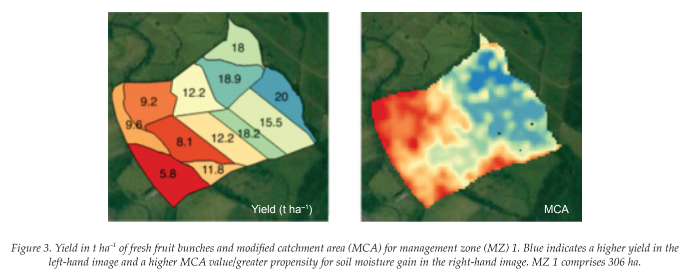
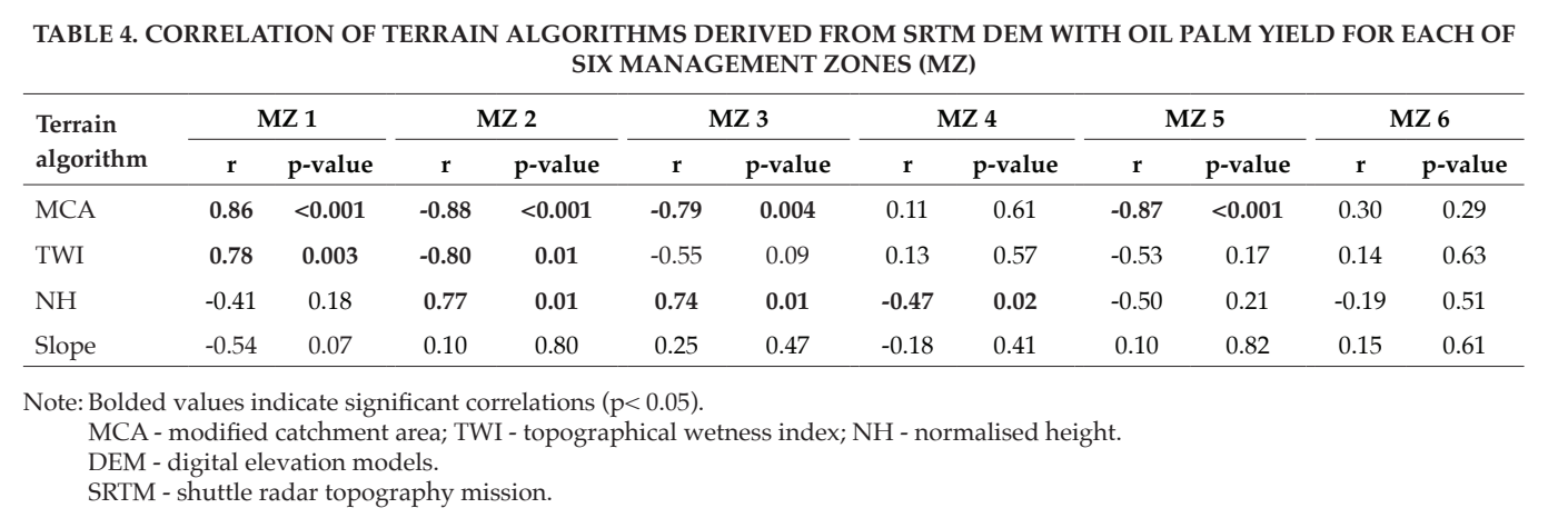
Oil palm (Elaeis guineensis Jacq.) plantations face strong pressure to improve fertiliser-use efficiency. Digital soil mapping methods based on topographic analysis using globally-available digital elevation models (DEM) provide an efficient means of uantifying topography-driven variability of soil properties within oil palm plantations. The shutter radar topography mission (RTM) global digital elevation model (DEM) was used as the basis for modeling topography across an individual oil palm plantation. Terrain algorithms were used to model terrain attributes and generate continuous soil property maps along topographic soil classes in conjunction with georeferenced soil samples as model inputs. The resulting raster layers of soil property values were evaluated for mean error and their correlation to yield variability across the plantation. Modified catchment area (M) an iterative measure of a landscape position represented by a grid cells propensity to lose or gain soil water was found to have a strong effect on yield suggesting that soil moisture distribution was an important driver of yield variability in this system.
FIGURES & TABLES:


* Purdue University,
403 West State Street, West Lafayette,
Indiana 47907-2050, USA.
E-mail: mart1142@purdue.edu
** Agricultural Research Service,
US Department of Agriculture,
Dale Bumpers Small Farms Research Centre,
6883 South Highway 23,
Booneville AR 72927, Arkansas, USA